Category:English-language maps
Jump to navigation
Jump to search
Please place all maps in English in this category.
Subcategories
This category has the following 32 subcategories, out of 32 total.
1
- 1955 Yellow Book maps (106 F)
A
- A system of geography (1878) (18 F)
C
E
- ECHO Base Maps (384 F)
L
M
- Maps using Pinyin (74 F)
N
- NOAA regional climate maps (205 F)
S
- Series 1501 (159 F)
Media in category "English-language maps"
The following 200 files are in this category, out of 4,565 total.
(previous page) (next page)-
1853 Mitchell Map of Asia - Geographicus - Asia-mitchell-1850.jpg 3,500 × 2,837; 3.95 MB
-
1853 Mitchell Map of India - Geographicus - Hindoostan-mitchell-1850.jpg 2,865 × 3,500; 4.02 MB
-
1853 Mitchell Map of Russia - Geographicus - Russia-mitchell-1853.jpg 2,521 × 3,000; 2.45 MB
-
1855 Colton Map of Hawaii and New Zealand - Geographicus - Hawaii-colton-1855.jpg 2,863 × 3,500; 2.63 MB
-
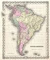
1855 Colton Map of South America - Geographicus - SouthAmerica-colton-1855.jpg 3,335 × 4,000; 4.04 MB
-
1855 Colton Map of Southern Africa - Geographicus - AfricaSouth-c-1855.jpg 4,000 × 3,257; 2.26 MB
-
1865 Comanche-Kiowa-Apache.png 948 × 523; 961 KB
-
1867 Comanche-Kiowa-KiowaApache.png 948 × 523; 952 KB
-
ONL (1887) 1.496 - Wren's Plan for Rebuilding London.jpg 1,924 × 1,255; 563 KB
-
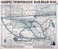
1908 Gospel Temperance Railroad.jpg 6,045 × 5,073; 6.65 MB
-
1909AtlasPlate13-Newtown-Ward2-Woodside-NYPL.jpg 3,360 × 2,400; 1.47 MB
-
1916 PRR Val map for Central of Maryland - map key.png 3,082 × 1,285; 5.22 MB
-
1941 atrocity in Jedwabne (map).jpg 522 × 547; 148 KB
-
1986 map showing the Soviet Military Forces.jpg 9,899 × 6,501; 12.6 MB
-
1990 Namibia CIA.png 1,977 × 2,470; 7.51 MB
-
2012 Edition China's Natural Gas Chemical Map.JPG 500 × 302; 92 KB
-
2014 Afghan Presidential Election-First Round-en.png 600 × 461; 25 KB
-
2015 Freedom Festival map - geograph.org.uk - 4652717.jpg 1,600 × 1,065; 434 KB
-
2016 Philippine presidential election provincial results.png 2,000 × 3,120; 191 KB
-
2018 Ukrainian Deaths.png 501 × 363; 118 KB
-
2021 Belarus-EU border crisis - general map.png 6,400 × 4,804; 1.14 MB
-
2022 Russian invasion of Ukraine siverskdonets river.png 611 × 579; 287 KB
-
3 Map of Marakei, Kiribati.jpg 725 × 1,024; 163 KB
-
36 hour rainfall totals and evidence of erosion in West Wales, 8th-9th June 2012.tif 6,704 × 4,657; 2.15 MB
-
4+4 PDL network in China (English version).png 2,000 × 1,700; 632 KB
-
7 Map of Maiana, Kiribati.jpg 777 × 873; 229 KB
-
7.5 minute series orthophotomap (topographic).jpg 3,783 × 4,500; 3.38 MB
-
7th field survey coy REEEF, Jerusalem water supply (FL25567903 2367756).jpg 12,121 × 17,178; 235.02 MB
-
81ArabAbbasidPeriod750-885.gif 700 × 456; 51 KB
-
87EarlyBagratid884-962 (1).gif 700 × 457; 69 KB
-
87EarlyBagratid884-962-pt.svg 512 × 330; 69 KB
-
87EarlyBagratid884-962.gif 700 × 457; 62 KB
-
93-vaspurakan908-1021.gif 700 × 486; 61 KB
-
A Chart of the Mediterranean (FL13732034 3370769).jpg 8,341 × 10,266; 115.1 MB
-
A chart of the sea coast of Spain from the straits mouth to C de Gat (FL13722341 2471232).jpg 9,196 × 7,546; 96.57 MB
-
A chart of the Straits of Babelmandell and Moha (FL33131127 2490788).jpg 14,115 × 11,452; 208.82 MB
-
A chronological chart of the Jewish Kingdom 01-map (FL49973424 4073144).jpg 8,281 × 5,647; 52.6 MB
-
A chronological chart of the Jewish Kingdom 02-verso (FL49973425 4073144).jpg 8,302 × 5,649; 61.88 MB
-
A draught of part of the Meditteranean Sea (FL13730440 3365550).jpg 9,657 × 7,598; 93.39 MB
-
A land cover map of the HKH region was developed using Landsat 30-meter data..png 1,859 × 1,050; 3.29 MB
-
A Map of ancient Africa (FL35469195 2370147).jpg 8,543 × 6,346; 73.37 MB
-
A map of ancient Europe (FL33132593 2522666).jpg 7,966 × 5,872; 64.5 MB
-
A map of Ancient Ægypt from Celarius (FL25570330 2512345).jpg 6,536 × 9,146; 77.63 MB
-
A map of Asia as inhabited by Shem (FL27963638 2488683).jpg 9,068 × 6,694; 76.8 MB
-
A map of Canaan (FL147421281 3714815).jpg 14,689 × 12,500; 186.81 MB
-
A map of Canaan describing the travels of Jesus Christ (FL35098603 3892379).jpg 6,361 × 4,651; 39.91 MB
-
A map of Canaan with the supposed portions of the Tribes (FL35103449 3892771).jpg 5,477 × 6,672; 47 MB
-
A map of Canaan, adapted to the book of Genesis (FL6881837 2508837).jpg 2,124 × 2,878; 1.83 MB
-
A map of Canaan, adapted to the book of Judges (FL200036867 2368466).jpg 2,436 × 3,232; 10.08 MB
-
A map of Canaan, adapted to the book of Judges (FL6880175 2508844).jpg 2,180 × 2,874; 1.78 MB
-
A map of Canaan, adapted to the book of Samuel (FL6881318 2508846).jpg 2,130 × 2,909; 1.84 MB
-
A map of Canaan, adapted to the books of Samuel (FL200036882 2368467).jpg 2,407 × 3,208; 9.79 MB
-
A map of Canaan, adapted to the Gospel history (FL200036828 2368469).jpg 2,440 × 3,220; 10.15 MB
-
A map of Canaan, shewing the captivieties of Israel and Judah (FL200036829 2368468).jpg 2,404 × 3,180; 10.73 MB
-
A map of north & south Wales (FL35475089 2582257).jpg 3,579 × 4,624; 22 MB
-
A map of North America's bioregions, improved from the previous.jpg 993 × 596; 121 KB
-
A map of Palestine (FL36012239 3897516).jpg 8,035 × 11,624; 118.87 MB
-
A map of Palestine (FL36012293 3898185).jpg 8,163 × 5,990; 57.72 MB
-
A map of Palestine describing the travels of Jesus Christ (FL6882862 2568223).jpg 4,712 × 3,276; 23.28 MB
-
A map of Palestine or the Holy land with the divisions into tribes (FL35081008 3890220).jpg 6,035 × 7,282; 62.3 MB
-
A map of Paradise mount Ararat and the city of Babel.according to the three (FL35098555 3892201).jpg 9,619 × 7,838; 101.52 MB
-
A map of the countries leading to Paradise (FL13729657 2515828).jpg 4,369 × 5,431; 28.42 MB
-
A map of the eastern province of the kingdom of Algiers (FL13725148 2494622).jpg 8,013 × 5,945; 70.64 MB
-
A map of the Holy Land (FL35098656 3892380).jpg 6,404 × 5,223; 44.7 MB
-
A map of the Land of Promise.compiled out of the book of Joshua (FL37121979 3898256).jpg 2,723 × 4,433; 4.52 MB
-
A map of the Terrestrial Paradise according to Mr. Huet (FL35080844 3890177).jpg 5,498 × 8,908; 64.68 MB
-
A map of ye province of Kilan as it lies on ye Caspian sea (FL155329244 2608432).jpg 8,557 × 7,684; 83.89 MB
-
A map shewing that part of Asia inhabited by Ham and Japhet (FL27963648 2488685).jpg 6,011 × 8,510; 60.59 MB
-
A map shewing the general dispersion and settling of the nations (FL13729008 2514516).jpg 4,680 × 4,032; 25.17 MB
-
A new and correct map of the trading part of the West Indies.png 2,780 × 1,567; 7.34 MB
-
A new chart of the Mediterranean Sea 01-west (FL13730729 3368782).jpg 8,585 × 11,602; 120.49 MB
-
A new chart of the Mediterranean Sea 02-center (FL13730733 3368782).jpg 8,693 × 11,723; 121.01 MB
-
A new chart of the Mediterranean Sea 03-east (FL13730737 3368782).jpg 8,701 × 11,592; 118.73 MB
-
A New map of Palestine or the Holy Land (FL37110389 3893101).jpg 5,793 × 6,990; 61.26 MB
-
A new map of Turkey in Europe divided into all its provinces (FL36011291 2882669).jpg 15,248 × 17,182; 356.74 MB
-
A plan of Jerusalem (FL45602950 3939234).jpg 1,030 × 1,670; 763 KB
-
A Plan of the city and port of Warran or Oran (FL163876629 2510706).jpg 3,508 × 4,867; 10.83 MB
-
A Plan of the city and port of Warran or Oran (FL163876652 2510889).jpg 3,231 × 5,595; 8.94 MB
-
A. J. Marks, The Holy Land (FL6879269 2368755).jpg 2,855 × 2,200; 3.59 MB
-
Aaron Arrowsmith the Younger, Southern Syria (FL200036970 2368305).jpg 3,418 × 4,296; 20.92 MB
-
Aaron Arrowsmith the Younger, Syria (FL6879830 2489649).jpg 2,250 × 2,779; 2.66 MB
-
Aaron Arrowsmith the Younger, Syria (FL6881183 2489646).jpg 2,250 × 2,759; 2.33 MB
-
Aaron Arrowsmith the Younger, Terra Sancta (FL200036676 2368306).jpg 3,467 × 4,311; 21.65 MB
-
Aaron Arrowsmith, Asia Minor (FL35868056 2714622).jpg 6,978 × 5,495; 57.02 MB
-
Aaron Arrowsmith, Lower Egypt (FL25570244 2503808).jpg 7,460 × 5,668; 62.54 MB
-
Aaron Arrowsmith, Map of Syria (FL6880898 2640493).jpg 10,301 × 15,865; 240.01 MB
-
Aaron Arrowsmith, Russia in Asia (FL147398513 2607998).jpg 7,307 × 5,583; 45.31 MB
-
Aaron Arrowsmith, Syria (FL13729648 2516127).jpg 3,840 × 4,890; 26.69 MB
-
Abkhazia detail map original.png 600 × 450; 36 KB
-
Aboriginal Australians Distribution.jpg 376 × 408; 32 KB
-
Abu Zenima (FL155909530 4073456).jpg 16,617 × 12,536; 217.21 MB
-
Ac-map.png 329 × 354; 7 KB
-
Acre firing ranges. zone of danger to aircraft (FL60908669 2646396).jpg 6,136 × 9,634; 62.65 MB
-
ACT area Murray County 1886.jpg 1,200 × 1,200; 253 KB
-
ACT legislative assembly electorates.png 800 × 661; 144 KB
-
ACT-Jervis Bay-MJC.png 1,200 × 1,008; 55 KB
-
ACTA 1.png 432 × 296; 48 KB
-
Action at Jericho (FL37128159 3902781).jpg 2,726 × 2,541; 2.54 MB
-
Aden (PSF).png 2,028 × 1,956; 765 KB
-
Administrative division of LPR en.svg 859 × 859; 301 KB
-
Admiralty Chart No 1654 File-J. & C. Walker, The Archipelago (FL37663320 3370988), Published 1849.jpg 12,425 × 16,384; 278.21 MB
-
Adriatic Sea Geographic Map.jpg 337 × 399; 129 KB
-
Advance through Philistia Situation (FL45612607 3958927).jpg 2,568 × 3,245; 2.91 MB
-
Adverse possession US.pdf 1,800 × 1,350; 1.05 MB
-
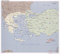
Aegean Sea region. LOC 2006625576.jpg 7,142 × 6,358; 8.18 MB
-
Afghan-big.jpg 1,378 × 1,480; 340 KB
-
Afghanistan - 2001.png 1,698 × 1,305; 71 KB
-
Afghanistan and Persia in 1856.jpg 3,481 × 2,955; 1.39 MB
-
Afghanistan District.png 1,223 × 989; 95 KB
-
Afghanistan Ethnolinguistic Groups 1972.jpg 1,072 × 843; 85 KB
-
Afghanistan Ethnolinguistic Groups 1982.jpg 1,434 × 922; 287 KB
-
Afghanistan Ethnolinguistic Groups 1997.jpg 1,045 × 1,040; 528 KB
-
Afghanistan insurgency 1985.jpg 2,401 × 1,876; 4.18 MB
-
Afghanistan map Herat.png 331 × 355; 34 KB
-
Afghanistan map.png 326 × 350; 11 KB
-
Afghanistan provinces 1996-2004.png 1,000 × 768; 38 KB
-
Afghanistan – U.S. area comparison.jpg 701 × 821; 468 KB
-
Africa (FL35469192 2370144).jpg 8,912 × 10,295; 116.29 MB
-
Africa (FL35470212 2496866).jpg 15,763 × 12,383; 255.76 MB
-
Africa's true size.jpg 2,482 × 1,755; 749 KB
-
Africa-map.jpg 505 × 627; 97 KB
-
AfricaCIA-HiRes.jpg 1,632 × 2,112; 2.01 MB
-
Afrique latine10.png 360 × 392; 15 KB
-
Age of Consent - north america2.png 429 × 557; 936 KB
-
Agricultural Settlement Department, Eretz Israel (FL168744098 3425597).jpg 12,800 × 20,564; 260.52 MB
-
Airline Routes in Middle America, March 1949 - DPLA - d779114cdb338448496f00e71d092f7f.jpg 12,007 × 8,849; 11.91 MB
-
AirTrain JFK map.png 599 × 845; 34 KB
-
AirTrain-JFK-Map.png 1,273 × 1,707; 264 KB
-
Akaba T.J (FL147409385 2763035).jpg 5,920 × 16,529; 84.06 MB
-
Aksai Chin Sino-Indian border map.png 624 × 872; 102 KB
-
Aksai Chin Sino-Indian border map.svg 650 × 990; 364 KB
-
Albania Provinces.png 960 × 2,153; 1.05 MB
-
Alberta map.png 403 × 596; 74 KB
-
Aleppo (FL167486078 3841069).jpg 7,933 × 3,931; 40.96 MB
-
Alexander Anderson, Jerusalem (FL184620846 2367984).jpg 4,384 × 3,528; 17.97 MB
-
Alexander Findlay, Palæstina (FL37119226 3896468).jpg 2,820 × 3,538; 4.8 MB
-
Alexander Keith Johnston, Basin of the Mediterranean (FL37663317 3370937).jpg 15,260 × 12,277; 274.71 MB
-
Alexander Keith Johnston, Canaan or Palestine (FL37129722 3912035).jpg 3,092 × 4,088; 6.35 MB
-
Alexander Keith Johnston, Palestine (FL36012634 3912043).jpg 10,498 × 17,370; 278.31 MB
-
Alexander Keith Johnston, Palestine or the Holy Land (FL170208320 2648795).jpg 10,917 × 14,413; 185.2 MB
-
Alexander Keith Johnston, Syria et Palæstina (FL37129713 3912025).jpg 3,137 × 3,873; 6.77 MB
-
Alexander Kincaid, Palestine or the Holy Land 01 (FL37119291 3896524).jpg 2,504 × 2,958; 3.86 MB
-
Alexander Kincaid, Palestine or the Holy Land 02-colored (FL37119299 3896524).jpg 2,061 × 2,770; 3.05 MB
-
Algeria map.jpg 2,357 × 2,940; 4.98 MB
-
Algeria – U.S. area comparison.jpg 701 × 671; 483 KB
-
Alois Musil, Northern Arabia 01 (FL155332408 2707343).jpg 14,325 × 14,910; 217.02 MB
-
Alois Musil, Northern Arabia 02 (FL155332409 2707343).jpg 14,342 × 14,916; 224.47 MB
-
Alois Musil, Northern Arabia 03 (FL155332410 2707343).jpg 14,330 × 14,922; 237.88 MB
-
Alois Musil, Northern Arabia 04 (FL155332411 2707343).jpg 14,334 × 14,936; 236.06 MB
-
Along the Magnificent Mile map.png 1,709 × 3,008; 1.22 MB
-
Alps regions.png 2,000 × 1,472; 390 KB
-
Altogether.gif 1,480 × 625; 243 KB
-
Amcolonies17th-WSC.gif 6,532 × 10,200; 894 KB
-
America's Marine Highway long term plan.jpg 1,204 × 928; 347 KB
-
American Baptist Mission in Szchuan.png 1,816 × 1,242; 679 KB
-
American Red Cross Map of Paris (7433408968).jpg 3,504 × 2,544; 2.2 MB
-
American Samoa Districts.png 2,112 × 1,632; 36 KB
-
Amman (FL147449296 0777978).jpg 15,704 × 12,002; 190.55 MB
-
AMPS World Sectors.png 1,051 × 518; 181 KB
-
An accurate map of the Holy Land with the adjacent countries (FL37116874 3893218).jpg 3,167 × 4,426; 4.06 MB
-
An exact map of the Crim (Formerly Taurica Chersonesus) (FL154452957 2608052).jpg 8,886 × 7,441; 71.79 MB
-
Anatolia Turkey.png 514 × 331; 41 KB
-
Ancient Greek Northern regions.png 554 × 500; 271 KB
-
Ancient Jerusalem (FL37110406 3893099).jpg 6,992 × 5,531; 55.1 MB
-
Ancient Map of Decatur County, Iowa.jpg 1,150 × 1,476; 1.05 MB
-
Ancient Palestine (FL35081084 3890405).jpg 8,601 × 10,495; 126.63 MB
%2C_Uruguay_and_Chili_-_Geographicus_-_LaPlata-mitchell-1850.jpg/97px-1853_Mitchell_Map_of_Argentina_(_La_Plata_)%2C_Uruguay_and_Chili_-_Geographicus_-_LaPlata-mitchell-1850.jpg)


_-_Geographicus_-_TurkeyAsia-mitchell-1850.jpg/120px-1853_Mitchell_Map_of_Turkey_in_Asia_(_Palestine%2C_Syria%2C_Iraq%2C_Turkey_)_-_Geographicus_-_TurkeyAsia-mitchell-1850.jpg)
_-_Geographicus_-_TurkeyEurope-mitchell-1850.jpg/98px-1853_Mitchell_Map_of_Turkey_in_Europe_and_Greece_(_Greece%2C_Balkans%2C_Macedonia_)_-_Geographicus_-_TurkeyEurope-mitchell-1850.jpg)


_1.496_-_Wren%27s_Plan_for_Rebuilding_London.jpg/120px-ONL_(1887)_1.496_-_Wren%27s_Plan_for_Rebuilding_London.jpg)
%2C_China_-_Geographicus_-_Taiwan-imray-1876.jpg/120px-1876_Imray_Blue-back_Nautical_Chart_or_Map_of_Taiwan_(Formosa)%2C_China_-_Geographicus_-_Taiwan-imray-1876.jpg)


.jpg/114px-1941_atrocity_in_Jedwabne_(map).jpg)
_-_landmark_Lunar_map%5E_-_Geographicus_-_PhotogeologicMoon-usgs-1961.jpg/120px-1961_U.S.G.S._Photogeologic_Map_of_the_Moon_(wall_map)_-_landmark_Lunar_map%5E_-_Geographicus_-_PhotogeologicMoon-usgs-1961.jpg)


%27_(11005451314).jpg/76px-242_of_%27(Pielgrzymka_..._do_Ziemi_Świętey%2C_Egiptu%2C_niektórych_wschodnich%2C_i_południowych_kraiów._Odbyta_w_roku_1788-91.)%27_(11005451314).jpg)

.jpg/120px-thumbnail.jpg)

.png/120px-4+4_PDL_network_in_China_(English_version).png)

.jpg/101px-7.5_minute_series_orthophotomap_(topographic).jpg)
.jpg/85px-7th_field_survey_coy_REEEF%2C_Jerusalem_water_supply_(FL25567903_2367756).jpg)

.gif/120px-87EarlyBagratid884-962_(1).gif)


.jpg/97px-A_Chart_of_the_Mediterranean_(FL13732034_3370769).jpg)
.jpg/120px-A_chart_of_the_sea_coast_of_Spain_from_the_straits_mouth_to_C_de_Gat_(FL13722341_2471232).jpg)
.jpg/120px-A_chart_of_the_Straits_of_Babelmandell_and_Moha_(FL33131127_2490788).jpg)
.jpg/120px-A_chronological_chart_of_the_Jewish_Kingdom_01-map_(FL49973424_4073144).jpg)
.jpg/120px-A_chronological_chart_of_the_Jewish_Kingdom_02-verso_(FL49973425_4073144).jpg)
.jpg/120px-thumbnail.jpg)
.jpg/120px-A_Description_of_a_view_of_Jerusalem%2C_now_exhibiting_at_the_Panorama%2C_Leicester_Square_(FL147449138_0777977).jpg)
.jpg/120px-A_draught_of_part_of_the_Meditteranean_Sea_(FL13730440_3365550).jpg)

.jpg/120px-A_Map_of_ancient_Africa_(FL35469195_2370147).jpg)
.jpg/120px-A_map_of_ancient_Europe_(FL33132593_2522666).jpg)
.jpg/86px-A_map_of_Ancient_Ægypt_from_Celarius_(FL25570330_2512345).jpg)
.jpg/120px-A_map_of_Asia_as_inhabited_by_Shem_(FL27963638_2488683).jpg)
.jpg/120px-A_map_of_Canaan_(FL147421281_3714815).jpg)
.jpg/120px-A_map_of_Canaan_describing_the_travels_of_Jesus_Christ_(FL35098603_3892379).jpg)
.jpg/98px-A_map_of_Canaan_with_the_supposed_portions_of_the_Tribes_(FL35103449_3892771).jpg)
.jpg/88px-A_map_of_Canaan%2C_adapted_to_the_book_of_Genesis_(FL6881837_2508837).jpg)
.jpg/90px-A_map_of_Canaan%2C_adapted_to_the_book_of_Judges_(FL200036867_2368466).jpg)
.jpg/91px-A_map_of_Canaan%2C_adapted_to_the_book_of_Judges_(FL6880175_2508844).jpg)
.jpg/88px-A_map_of_Canaan%2C_adapted_to_the_book_of_Samuel_(FL6881318_2508846).jpg)
.jpg/90px-A_map_of_Canaan%2C_adapted_to_the_books_of_Samuel_(FL200036882_2368467).jpg)
.jpg/91px-A_map_of_Canaan%2C_adapted_to_the_Gospel_history_(FL200036828_2368469).jpg)
.jpg/91px-A_map_of_Canaan%2C_shewing_the_captivieties_of_Israel_and_Judah_(FL200036829_2368468).jpg)
.jpg/93px-A_map_of_north_%26_south_Wales_(FL35475089_2582257).jpg)

.jpg/83px-A_map_of_Palestine_(FL36012239_3897516).jpg)
.jpg/120px-A_map_of_Palestine_(FL36012293_3898185).jpg)
.jpg/120px-A_map_of_Palestine_describing_the_travels_of_Jesus_Christ_(FL6882862_2568223).jpg)
.jpg/99px-A_map_of_Palestine_or_the_Holy_land_with_the_divisions_into_tribes_(FL35081008_3890220).jpg)
.jpg/120px-A_map_of_Paradise_mount_Ararat_and_the_city_of_Babel.according_to_the_three_(FL35098555_3892201).jpg)
.jpg/120px-thumbnail.jpg)
.jpg/96px-A_map_of_the_countries_leading_to_Paradise_(FL13729657_2515828).jpg)
.jpg/120px-A_map_of_the_eastern_province_of_the_kingdom_of_Algiers_(FL13725148_2494622).jpg)
.jpg/120px-A_map_of_the_Holy_Land_(FL35098656_3892380).jpg)
.jpg/120px-A_map_of_the_Holy_Land_divided_into_the_XII_Tribes_of_Israel_wherein_is_exactly_Mark%27d_the_travels_of_Jesus_Christ_(FL35098813_3892378).jpg)
.jpg/120px-A_map_of_the_Holy_Land_divided_into_the_XII_Tribes_of_Israel_wherein_is_exactly_mark%27d_ye_travels_of_Iesus_Christ_(FL35098655_3892325).jpg)
.jpg/120px-thumbnail.jpg)
.jpg/120px-A_map_of_the_journeyings_of_the_children_of_Israel_from_Egypt_through_the_wilderness_to_Canaan.as_described_Numbers_XXXIII_(FL35098774_3892713).jpg)
.jpg/120px-A_map_of_the_journeys_of_the_Israelites_from_Rameses_in_Egypt_to_their_encampment_on_the_east_side_of_ye_River_Jordan_(FL35098591_3892373).jpg)
.jpg/120px-A_map_of_the_land_of_Canaan_shewing_the_situation_of_the_principal_places_mentioned_in_the_histories_of_Joshua_%26_the_Judges_(FL45612622_3959050).jpg)
.jpg/120px-A_Map_of_the_land_of_Canaan%2C_shewing_the_situation_of_the_principal_places_mentioned_in_the_Histories_of_Joshua_%26_the_Judges_(FL37821307_3923012).jpg)
.jpg/120px-A_map_of_the_Land_of_Canaan%2C_shewing_the_situation_of_the_principal_places_mentioned_in_the_histories_of_Joshua_%26_the_Judges_(FL45601995_3934941).jpg)
.jpg/74px-A_map_of_the_Land_of_Promise.compiled_out_of_the_book_of_Joshua_(FL37121979_3898256).jpg)
.jpg/74px-A_map_of_the_Terrestrial_Paradise_according_to_Mr._Huet_(FL35080844_3890177).jpg)
.jpg/120px-A_map_of_ye_province_of_Kilan_as_it_lies_on_ye_Caspian_sea_(FL155329244_2608432).jpg)
.jpg/85px-A_map_shewing_that_part_of_Asia_inhabited_by_Ham_and_Japhet_(FL27963648_2488685).jpg)
.jpg/120px-A_map_shewing_the_general_dispersion_and_settling_of_the_nations_(FL13729008_2514516).jpg)
.jpg/120px-A_map_shewing_the_situation_of_the_places_mentioned_in_the_history_of_the_acts_of_the_Apostles_(FL35098499_3892158).jpg)
.jpg/120px-A_Map_Shewing_the_Situation_of_the_Principal_Places_mentioned_in_the_History_of_the_Kings_of_Judah_%26_Israel_(FL37821424_3923013).jpg)


.jpg/89px-A_new_chart_of_the_Mediterranean_Sea_01-west_(FL13730729_3368782).jpg)
.jpg/89px-A_new_chart_of_the_Mediterranean_Sea_02-center_(FL13730733_3368782).jpg)
.jpg/90px-A_new_chart_of_the_Mediterranean_Sea_03-east_(FL13730737_3368782).jpg)
.jpg/99px-A_New_map_of_Palestine_or_the_Holy_Land_(FL37110389_3893101).jpg)
.jpg/120px-A_New_Map_of_the_several_Countries%2C_Cities%2C_Towns_%26c_mention%27d_in_the_New_Testament_as_were_in_the_Holy_Land_and_parts_adjoining_(FL37119176_3896394).jpg)
.jpg/106px-A_new_map_of_Turkey_in_Europe_divided_into_all_its_provinces_(FL36011291_2882669).jpg)
.jpg/120px-A_perspective_view_of_the_Church_of_the_Holy_Sepulchre_at_Jerusalem.and_other_sturctures_(FL37251447_3914900).jpg)
.jpg/74px-A_plan_of_Jerusalem_(FL45602950_3939234).jpg)
.jpg/86px-A_Plan_of_the_city_and_port_of_Warran_or_Oran_(FL163876629_2510706).jpg)
.jpg/69px-A_Plan_of_the_city_and_port_of_Warran_or_Oran_(FL163876652_2510889).jpg)
.jpg/120px-A._J._Marks%2C_The_Holy_Land_(FL6879269_2368755).jpg)
.jpg/95px-Aaron_Arrowsmith_the_Younger%2C_Southern_Syria_(FL200036970_2368305).jpg)
.jpg/97px-Aaron_Arrowsmith_the_Younger%2C_Syria_(FL6879830_2489649).jpg)
.jpg/98px-Aaron_Arrowsmith_the_Younger%2C_Syria_(FL6881183_2489646).jpg)
.jpg/96px-Aaron_Arrowsmith_the_Younger%2C_Terra_Sancta_(FL200036676_2368306).jpg)
.jpg/120px-Aaron_Arrowsmith%2C_Asia_Minor_(FL35868056_2714622).jpg)
.jpg/120px-Aaron_Arrowsmith%2C_Lower_Egypt_(FL25570244_2503808).jpg)
.jpg/78px-Aaron_Arrowsmith%2C_Map_of_Syria_(FL6880898_2640493).jpg)
.jpg/120px-Aaron_Arrowsmith%2C_Russia_in_Asia_(FL147398513_2607998).jpg)
.jpg/94px-Aaron_Arrowsmith%2C_Syria_(FL13729648_2516127).jpg)


.jpg/120px-Abu_Zenima_(FL155909530_4073456).jpg)

.jpg/76px-Acre_firing_ranges._zone_of_danger_to_aircraft_(FL60908669_2646396).jpg)


.jpg/120px-Action_at_Jericho_(FL37128159_3902781).jpg)
.png/120px-Aden_(PSF).png)

%2C_Published_1844.jpg/90px-thumbnail.jpg)
%2C_Published_1849.jpg/91px-Admiralty_Chart_No_1654_File-J._%26_C._Walker%2C_The_Archipelago_(FL37663320_3370988)%2C_Published_1849.jpg)

.jpg/95px-Advance_through_Philistia_Situation_(FL45612607_3958927).jpg)


.jpg/104px-Africa_(FL35469192_2370144).jpg)
.jpg/120px-Africa_(FL35470212_2496866).jpg)


.jpg/75px-Agricultural_Settlement_Department%2C_Eretz_Israel_(FL168744098_3425597).jpg)


.jpg/120px-Aleppo_(FL167486078_3841069).jpg)
.jpg/120px-Alexander_Anderson%2C_Jerusalem_(FL184620846_2367984).jpg)
.jpg/96px-Alexander_Findlay%2C_Palæstina_(FL37119226_3896468).jpg)
.jpg/120px-Alexander_Keith_Johnston%2C_Basin_of_the_Mediterranean_(FL37663317_3370937).jpg)
.jpg/91px-Alexander_Keith_Johnston%2C_Canaan_or_Palestine_(FL37129722_3912035).jpg)
.jpg/72px-Alexander_Keith_Johnston%2C_Palestine_(FL36012634_3912043).jpg)
.jpg/91px-Alexander_Keith_Johnston%2C_Palestine_or_the_Holy_Land_(FL170208320_2648795).jpg)
.jpg/97px-Alexander_Keith_Johnston%2C_Syria_et_Palæstina_(FL37129713_3912025).jpg)
.jpg/102px-Alexander_Kincaid%2C_Palestine_or_the_Holy_Land_01_(FL37119291_3896524).jpg)
.jpg/89px-Alexander_Kincaid%2C_Palestine_or_the_Holy_Land_02-colored_(FL37119299_3896524).jpg)


.jpg/115px-Alois_Musil%2C_Northern_Arabia_01_(FL155332408_2707343).jpg)
.jpg/115px-Alois_Musil%2C_Northern_Arabia_02_(FL155332409_2707343).jpg)
.jpg/115px-Alois_Musil%2C_Northern_Arabia_03_(FL155332410_2707343).jpg)
.jpg/115px-Alois_Musil%2C_Northern_Arabia_04_(FL155332411_2707343).jpg)


.jpg/120px-America%2C_with_the_European_Settlements%2C_and_the_conquests_of_Cortes_and_Pizarro_(4071873177).jpg)

.jpg/120px-American_Red_Cross_Map_of_Paris_(7433408968).jpg)

.jpg/120px-Amman_(FL147449296_0777978).jpg)

.jpg/75px-An_Accurate_Map_of_the_Holy_Land_as_when_travellled_over_by_Our_Saviour_and_his_Apostles_(FL37119245_3896478).jpg)
.jpg/86px-An_accurate_map_of_the_Holy_Land_with_the_adjacent_countries_(FL37116874_3893218).jpg)
.jpg/120px-An_accurate_map_of_the_travels_of_the_Apostles_with_St._Paul%27s_Voyage_to_Rome_(FL37121985_3898255).jpg)
_(FL154452957_2608052).jpg/120px-An_exact_map_of_the_Crim_(Formerly_Taurica_Chersonesus)_(FL154452957_2608052).jpg)


.jpg/120px-Ancient_Jerusalem_(FL37110406_3893099).jpg)

.jpg/98px-Ancient_Palestine_(FL35081084_3890405).jpg)