Category:English-language maps
Jump to navigation
Jump to search
Please place all maps in English in this category.
Subcategories
This category has the following 32 subcategories, out of 32 total.
1
- 1955 Yellow Book maps (106 F)
A
- A system of geography (1878) (18 F)
C
E
- ECHO Base Maps (384 F)
L
M
- Maps using Pinyin (74 F)
N
- NOAA regional climate maps (205 F)
S
- Series 1501 (159 F)
Media in category "English-language maps"
The following 200 files are in this category, out of 4,565 total.
(previous page) (next page)-
1-12 Blue-White Map World.png 4,572 × 2,500; 1.98 MB
-
105ByzantExpan3-966-1064.png 700 × 473; 67 KB
-
129 of 'The “Beaumont” Geography and Map Tracing Book' (11245500063).jpg 2,030 × 2,543; 1.09 MB
-
130 new villages on J. N. F. land 01 (FL147393889 2531496).jpg 2,455 × 6,520; 18.32 MB
-
130 new villages on J. N. F. land 02 (FL147393915 2531496).jpg 2,480 × 6,534; 15.07 MB
-
130 new villages on J. N. F. land 03 (FL147393958 2531496).jpg 5,120 × 4,696; 20.94 MB
-
130 new villages on J. N. F. land 04 (FL147393959 2531496).jpg 5,112 × 4,660; 22.58 MB
-
Jacob Peeters, Insula Di Candia Del Mare Mediteranea (FL35071107 2530471).jpg 6,724 × 4,013; 39.49 MB
-
1744 Wren Map of London, England - Geographicus - London-wren-1744.jpg 5,000 × 3,496; 4.43 MB
-
1746 Herman Moll Map of Carolina - Geographicus - CarolinabyMoll-moll-1746.jpg 3,400 × 2,494; 2.96 MB
-
1748 Anson View of Zihuatanejo Harbor, Mexico - Geographicus - Seguataneo-anson-1748.jpg 4,000 × 1,575; 1.84 MB
-
1762 A plan of the city of Cadis.jpg 9,012 × 6,422; 8.42 MB
-
1763 Gibson Map of East and West Florida - Geographicus - Florida-GM-1763.jpg 3,081 × 2,374; 1.18 MB
-
1777 Cook Map of the Friendly Islands or Tonga - Geographicus - FriendlyIsles-cook-1777.jpg 3,000 × 1,970; 1.54 MB
-
1780 Cook - Hogg Map of Tahiti ( Society Islands ) - Geographicus - Tahiti-hogg-1780.jpg 4,000 × 2,138; 912 KB
-
1784 Bocage Map of Athens, Greece - Geographicus - Athens-bocage-1784.jpg 3,000 × 1,951; 1.45 MB
-
1784 D'Anville Wall Map of Asia - Geographicus - Asia-anville-1794.jpg 7,000 × 6,074; 11.94 MB
-
1784 Map of the Battle of Plataea, Greece - Geographicus - BattleofPlataea-bocage-1784.jpg 3,500 × 2,180; 2.52 MB
-
1786 Bocage Map of Messenia in Ancient Greece - Geographicus - Messemoa-white-1793.jpg 1,200 × 1,053; 310 KB
-
1794 Laurie and Whittle Wall Map of Russia - Geographicus - Russia-lauriewhittle-1794.jpg 6,000 × 2,350; 4.42 MB
-
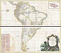
1795 D'Anville Wall Map of South America - Geographicus - SouthAmerica-laruiewhittle-1794.jpg 7,000 × 6,110; 10.18 MB
-
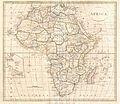
1799 Clement Cruttwell Map of Africa - Geographicus - Africa-cruttwell-1799.jpg 3,500 × 3,041; 2.64 MB
-
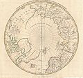
1799 Clement Cruttwell Map of North Pole - Geographicus - NorthPole-cruttwell-1799.jpg 3,500 × 3,289; 2.71 MB
-
1799 Clement Cruttwell Map of West Indies - Geographicus - WestIndies-cruttwell-1799.jpg 3,500 × 2,604; 2.29 MB
-
1800 Faden Rennell Wall Map of India - Geographicus - India-faden-1795.jpg 6,000 × 7,353; 10.85 MB
-
1800 Map of Peninsular India-1795.jpg 5,936 × 7,137; 50.39 MB
-
1801 Cary Map of the East Indies and Southeast Asia signifying Champa.png 790 × 721; 1.47 MB
-
1802 A new map of Europe.jpg 2,448 × 3,264; 1.67 MB
-
1806 Cary Map of India or Hindoostan - Geographicus - India-cary-1806.jpg 5,000 × 4,054; 5.77 MB
-
1806 Cary Map of Tartary or Central Asia - Geographicus - Tartary-cary-1806.jpg 5,000 × 4,569; 8.57 MB
-
1806 Mogg Pocket or Case Map of London, England - Geographicus - London-mogg-1806.jpg 7,000 × 3,813; 7.83 MB
-
1809 Pinkerton Map of Korea ^ Japan - Geographicus - JapanKorea-pinkerton-1809.jpg 3,000 × 2,329; 1.54 MB
-
1809 Pinkerton Map of Southern Africa - Geographicus - SouthernAfrica-pinkerton-1809.jpg 4,000 × 2,935; 1.73 MB
-
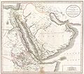
1811 Cary Map of Arabia, Egypt ^ Abyssinia - Geographicus - Arabia-cary-1811.jpg 4,000 × 3,540; 2.84 MB
-
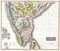
1814 Thomson Map of India - Geographicus - IndiaSouth-t-1814.jpg 3,300 × 2,799; 2.37 MB
-
1814 Thomson Map of India w-Ganges - Geographicus - Hindoostan-t-1814.jpg 5,000 × 3,779; 4.41 MB
-
1814 Thomson Map of Mexico and Texas - Geographicus - SpanishNorthAmerica-thomson-1814.jpg 5,000 × 4,107; 6.03 MB
-
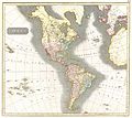
1814 Thomson Map of North and South America - Geographicus - America-t-1815.jpg 3,500 × 3,123; 2.41 MB
-
1814 Thomson Map of the Atlantic Ocean - Geographicus - Atlantic-t-1814.jpg 5,000 × 3,990; 2.94 MB
-
1814 Thomson Map of the West Indies ^ Central America - Geographicus - WestIndies-t-1814.jpg 5,000 × 4,215; 4.41 MB
-
1815 Thomson Map of Attica (Anthens and Vicinity) Greece - Geographicus - Attica-t-1814.jpg 4,010 × 5,604; 3.19 MB
-
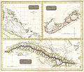
1815 Thomson Map of Cuba. Bermuda ^ the Bahamas - Geographicus - Cuba-t-1816.jpg 3,500 × 2,993; 2.07 MB
-
1815 Thomson Map of Prussia, Germany - Geographicus - Prussia-t-15.jpg 5,000 × 4,212; 3.61 MB
-
1818 Pinkerton Map of Chile - Geographicus - Chili-pinkerton-1818.jpg 3,661 × 5,000; 3.76 MB
-
1818 Pinkerton Map of Egypt - Geographicus - Egypt-pinkerton-1818.jpg 5,000 × 6,990; 8.39 MB
-
1818 Pinkerton Map of Korea and Japan - Geographicus - JapanKorea-pinkerton-1818.jpg 3,500 × 2,733; 2.12 MB
-
1818 Pinkerton Map of Mecran (Balochistan).jpg 2,226 × 1,341; 758 KB
-
1818 Pinkerton Map of Northern Scotland - Geographicus - ScotlandNorth-pinkerton-1818.jpg 5,000 × 3,724; 4.71 MB
-
1818 Pinkerton Map of Peru - Geographicus - Peru-pinkerton-1818.jpg 6,000 × 4,393; 6.5 MB
-
1819 Cary Map of Arabia, Egypt ^ Abyssinia - Arabia.jpg 2,000 × 1,789; 1,008 KB
-
182 of '(Italy and her Invaders, Vol. 1-4.)' (11219718116).jpg 2,352 × 1,468; 701 KB
-
1820 Lizars Wall Map of Asia (in two panels) - Geographicus - Asia-lizars-1820.jpg 5,000 × 4,531; 6.65 MB
-
1821 Carey Map of India - Geographicus - India-carey-1821 (cropped).jpg 3,136 × 3,333; 2.57 MB
-
1821 Carey Map of India - Geographicus - India-carey-1821.jpg 5,000 × 4,130; 6.29 MB
-
1826 Assheton Map of Russia in Asia - Geographicus - RussiaInAsia-assheton-1826.jpg 3,500 × 2,789; 2.67 MB
-
1827 Finley Map of Canada (Ontario, Quebec) - Geographicus - Canada-finley-1827.jpg 3,000 × 2,317; 1.87 MB
-
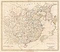
1827 Finley Map of China - Geographicus - China-finley-1827.jpg 3,000 × 2,308; 2.02 MB
-
1827 Finley Map of India - Geographicus - Hindoostan-finely-1827.jpg 2,310 × 3,000; 1.98 MB
-
1832 S.D.U.K. City Plan or Map of Pompeii, Italy - Geographicus - Pompeii-SDUK-1832.jpg 3,500 × 2,762; 2.63 MB
-
1836 Cary Map of Greece and the Balkans - Geographicus - TurkeyinEurope-cary-1836.jpg 3,063 × 3,777; 2.02 MB
-
1837 Malte-Brun Map of England - Geographicus - England-mb-1837.jpg 1,593 × 2,118; 496 KB
-
1840s Map of Kirribilli Point.jpg 760 × 604; 106 KB
-
1842 S.D.U.K. Map of the City of Calcutta, India - Geographicus - Calcutta-sduk-1842.jpg 3,500 × 2,800; 2.45 MB
-
1843 Blackwell Map of Niagara Falls, New York - Geographicus - NiagaraFalls-haines-1843.jpg 4,000 × 2,348; 3.12 MB
-
1844 SDUK Map EUROPE From The Society for the Diffusion of Useful Knowledge London.jpg 4,880 × 3,940; 6.88 MB
-
1846 Burroughs - Mitchell Map of Kentucky - Geographicus - KT-m-1846.jpg 2,835 × 2,340; 1.84 MB
-
1846 Emmons Agricultural Map of New York State - Geographicus - NewYork-emmons-1846.jpg 4,000 × 3,108; 3.34 MB
-
1846 Mitchell - Burroughs Map of South Carolina - Geographicus - SC-m-1846.jpg 3,500 × 2,831; 2.69 MB
-
1846 Mitchell - Tanner Map of New Jersey - Geographicus - NewJersey-mitchell-1848.jpg 3,878 × 4,653; 3.32 MB
-
1846 Mitchell's Map of Texas Oregon and California - Geographicus - TXORCA-mitchell-1846.jpg 5,000 × 5,420; 5.64 MB
-
1848 Public Survey Map of Wisconsin - Geographicus - WI-gs-1848.jpg 2,500 × 2,181; 848 KB
-
1848 U.S. Coast Survey Map of New England - Geographicus - NewEngland-uscs-1848.jpg 3,000 × 4,552; 2.15 MB
-
1848 U.S. Coast Survey Map of the Delaware Bay - Geographicus - DelawareBay-uscs-1848.jpg 3,000 × 4,193; 1.76 MB
-
1849 Cruchley Pocket Map of London, England - Geographicus - London-crutchley-1849.jpg 5,000 × 2,607; 4.89 MB
-
1850 Cowperthwait - Mitchell Map of Boston.jpg 900 × 1,160; 368 KB
-
1850 Cowperthwait - Mitchell Map of Indiana - Geographicus - IN-m-50.jpg 2,503 × 3,000; 2.18 MB
-
1850 Cowperthwait - Mitchell Map of Pennsylvania - Geographicus - PA-m-50.jpg 3,000 × 2,417; 2.34 MB
-
1850 Cowperthwait Map of Kentucky - Geographicus - KT-m-50.jpg 3,000 × 2,558; 2.24 MB
-
1850 Land Survey Map of Missouri - Geographicus - MO-ls-1850.jpg 2,800 × 2,216; 1.18 MB
-
1850 Mitchell - Mitchell Map of Turkey in Asia - Geographicus - TurkeyAsia-m-50.jpg 4,000 × 3,278; 3.18 MB
-
1850 Mitchell Map of Arabia, Persia, Afghanistan - Geographicus - Arabia-mitchell-1850.jpg 3,500 × 2,865; 2.77 MB
-
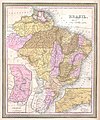
1850 Mitchell Map of Brazil, Paraguay and Guiana - Geographicus - Brazil-m-1849.jpg 3,342 × 4,000; 2.54 MB
-
1850 Mitchell Map of Eastern Canada including Quebec - Geographicus - CanadaQuebec-c-50.jpg 2,500 × 2,021; 1.63 MB
-
1850 Mitchell Map of Maine - Geographicus - Maine-mitchell-1850.jpg 3,166 × 4,000; 2.68 MB
-
1850 Mitchell Map of Mexico ^ Texas - Geographicus - MexicoTexas-m-50.jpg 3,117 × 2,533; 2.37 MB
-
1850 Mitchell map of Nicaragua.jpg 939 × 691; 208 KB
-
1850 Mitchell Map of Ohio - Geographicus - Ohio-m-50.jpg 3,313 × 4,000; 3.68 MB
-
1850 Mitchell Map of Persia, Arabia and Afghanistan - Geographicus - Arabia-m-50.jpg 4,000 × 3,284; 3.01 MB
-
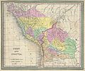
1850 Mitchell Map of Peru and Bolivia - Geographicus - PeruBolivia-mitchell-1850.jpg 3,500 × 2,904; 3.55 MB
-
1850 Mitchell Map of Prussia Germany - Geographicus - Prussia-m-50.jpg 2,000 × 1,620; 955 KB
-
1850 Mitchell Map of South America - Geographicus - SouthAmerica-mitchell-1850.jpg 3,000 × 3,715; 2.41 MB
-
1850 Mitchell Map of Spain and Portugal - Geographicus - Spain-c-53.jpg 3,000 × 2,411; 2.33 MB
-
1850 Mitchell Map of Spain and Portugal - Geographicus - SpainPortugal-mitchell-1850.jpg 3,000 × 2,423; 1.68 MB
-
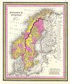
1850 Mitchell Map of Sweden and Norway - Geographicus - SwedenNorway-m-50.jpg 2,495 × 3,000; 2.12 MB
-
1850 Mitchell Map of Washington D.C. ^ Georgetown - Geographicus - WashingtonDC-m-1850.jpg 4,000 × 3,234; 3.03 MB
-
1850 Public Survey Map of Indiana - Geographicus - IN-ls-1850.jpg 2,000 × 3,416; 1.4 MB
-
1850 Tallis - Rapkin Map of the United States - Geographicus - USA-tlls-1850.jpg 2,737 × 2,045; 1.5 MB
-
1850 Tallis Map of South America - Geographicus - SouthAmerica-tallis-1850.jpg 2,781 × 4,000; 3.75 MB
-
1851 Map of Georgetown, crop from 1851 Map of the City.jpg 2,964 × 2,944; 5.57 MB
-
1851 Map of the City of Washington D.jpg 12,424 × 9,409; 44.37 MB
-
1852 Colton Sectional Pocket Map of Illinois - Geographicus - Illinois-colton-1852.jpg 4,015 × 6,000; 6.62 MB


%27_(11244667554).jpg)

.jpg)
.jpg)
.jpg)
.jpg)
.jpg)
.jpg)
_-_geographicus_-_newenglandnewyork-moll-1729.jpg)


.jpg)
.jpg)
.jpg)


.jpg)


_-_geographicus_-_america-bowen-1747.jpg)
_-_geographicus_-_oldgreenland-bowen-1747.jpg)
_-_geographicus_-_carolinageorgia-bowen-1747.jpg)


_scull_%5e_heap_map_of_philadelphia_%5e_environs_(first_view_of_phillidelphia_state_house)_-_geographicus_-_philadelphia-sculllobach-1850.jpg)
_-_geographicus_-_defonte-1754.jpg)


_-_geographicus_-_edinburgh-craig-1768.jpg)

_-_geographicus_-_tahiti-hogg-1780.jpg)


.jpg)


_-_geographicus_-_elis-white-1793.jpg)
_-_geographicus_-_thessaly-white-1793.jpg)

_-_geographicus_-_africa2-boulton-1794_a_001.jpg)
_-_geographicus_-_africa2-boulton-1794.jpg)



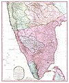
_-_geographicus_-_santodomingo-stockdale-1800.jpg)
_-_geographicus_-_eastindies-cary-1801.jpg)
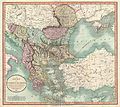

_-_geographicus_-_westernterritory-cary-1805.jpg)

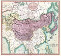


.jpg)
_-_geographicus_-_persia-pinkerton-1811.jpg)
_-_geographicus_-_westernafrica-pinkerton-1813.jpg)


_-_geographicus_-_martiniquedominica-thomson-1814.jpg)


%2c_italy_-_geographicus_-_venetianstates-t-1814.jpg)

_greece_-_geographicus_-_attica-t-1814.jpg)
_-_geographicus_-_guadaloupe-t-15.jpg)
%2c_italy_-_geographicus_-_milanesestates-t-1815.jpg)
%2c_sudan_%5e_nubia_-_geographicus_-_abysinnia-pinkerton-1818.jpg)


_-_geographicus_-_india-pinkerton-1818.jpg)


.jpg)

_-_geographicus_-_newgranada-pinkerton-1818.jpg)

_-_geographicus_-_persia2-pinkerton-1818.jpg)

_-_geographicus_-_worldeh-pinkerton-1818.jpg)

_-_geographicus_-_westernafrica-pinkerton-1818.jpg)
%27_(11219718116).jpg)
_-_geographicus_-_asia-lizars-1820.jpg)
_-_geographicus_-_london24-mogg-1820.jpg)
.jpg)


_-_geographicus_-_canada-finley-1827.jpg)




_-_geographicus_-_arcticexp-murray-1835.jpg)




.jpg)


_-_geographicus_-_nyc33miles-colton-1879.jpg)


_-_geographicus_-_newyork33milesaround-colton-1855.jpg)


%2c_martha%27s_vineyard%2c_massachusetts_-_geographicus_-_holmeshole-uscs-1847.jpg)
_-_geographicus_-_newyork33miles-colton-1848.jpg)

_-_geographicus_-_unitedstates-phelps-1848.jpg)

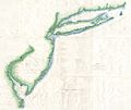


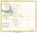

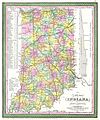


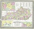

.jpg)










_-_geographicus_-_unitedstates-tallis-1850.jpg)


_-_geographicus_-_indepndenttartary-tallis-1851.jpg)



_-_geographicus_-_newyork33miles-colton-1853.jpg)